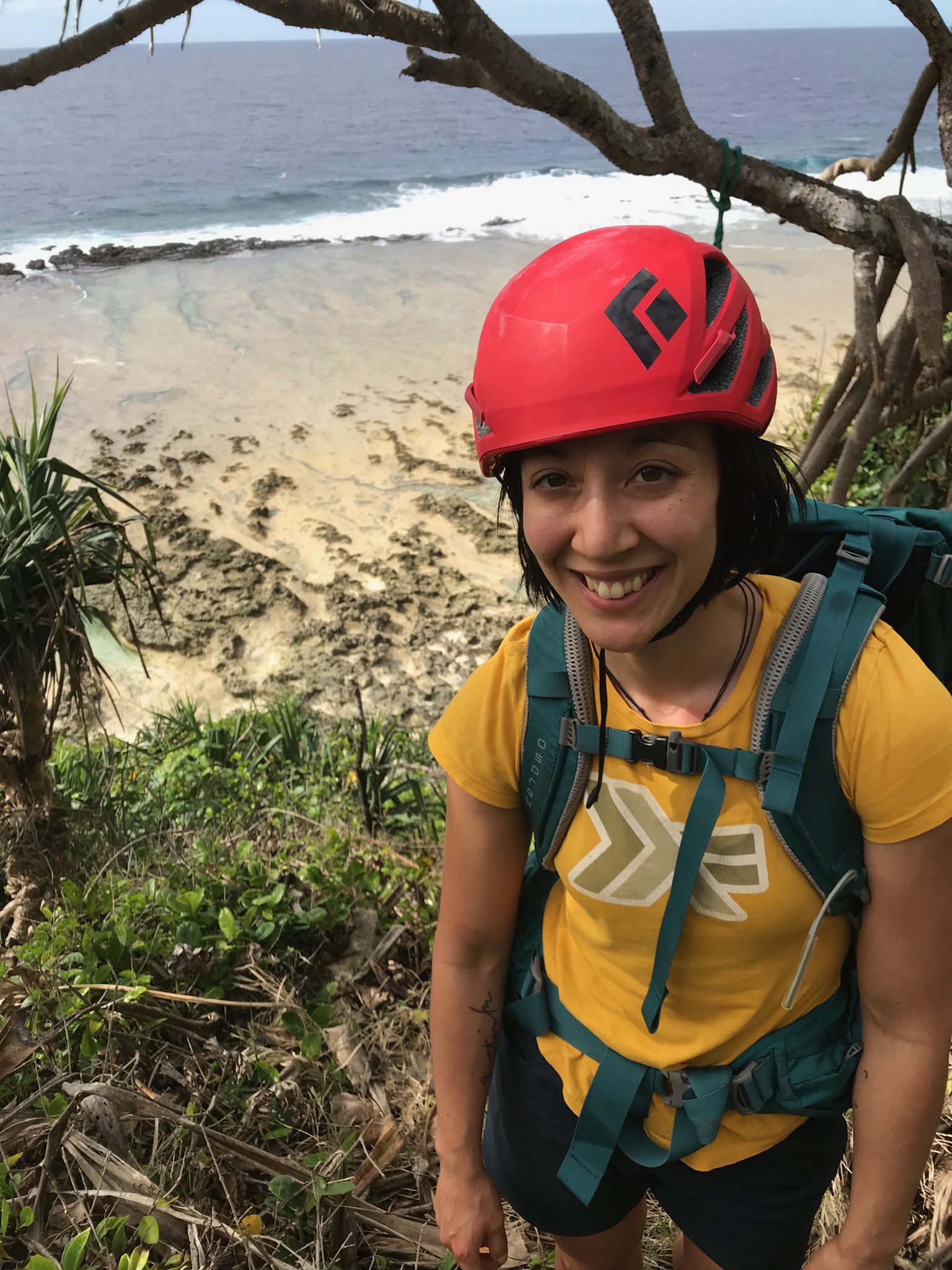
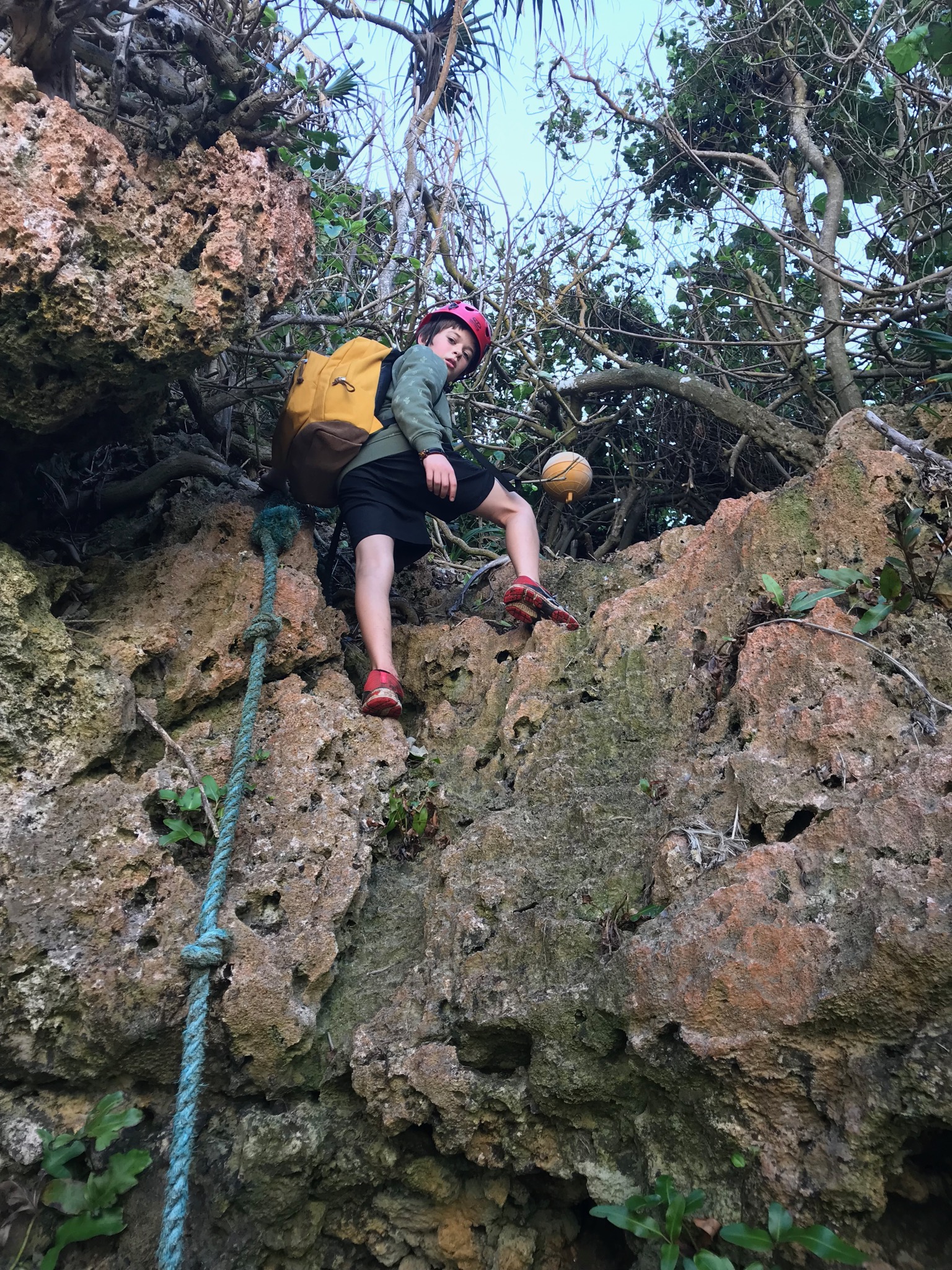
Rock climbing on 'Eua island, Tonga

Winter school holidays in New Zealand fall in July. For the last few years we have taken a week off for skiing in Queenstown, generally at the Remarkables ski field. While that sort of holiday is super fun, it is also expensive and the crowds seem to get bigger every year. This year is our first winter since we started rock climbing as a family. So we decided to take a climbing holiday. Alex has never been to a tropical pacific island, so we thought to try to roll the two into one. As it turns out - due to recent efforts over the last four years to set up sport climbing routes on ‘Eua island in Tonga - we found a perfect solution :)
Because our plans were only made a few weeks in advance we couldn’t secure accommodation for the whole week on ‘Eua island. So we spent the first three nights on the main island of Tongatapu.
Saturday
Our very short flight out to ‘Eua was early on Saturday morning and after checking in to our lovely accommodation we took our rental car straight North onto the narrow 4WD tracks leading to the access to Fangatave beach.
The tracks were greasy from overnight rain on the first morning and our local guide was driving a 2WD van that could not navigate the slippery ruts in the road. So we had to stop well short of the closest approach that a 4WD vehicle could achieve. Our guide had other places to be, so he left us with some verbal instructions (follow the road, turn right after the water tanks, then left when you reach the cliff tops, keeping the cliff-tops to your right to descend to Fangatave beach). As it turns out these instructions were meant for skilled navigators only! By the time we started our approach on foot it was 10am in the morning. Firstly we continued up the “road” from the intersection where we parked our car for what seemed like about half an hour (with packs full of climbing gear, food, water, et cetera). We were expecting to see water tanks, but after a long uphill hike, the track turned north-west into deeper forest, and we eventually arrived at a locked gate with barbed wire. It looked very uninviting and we had clearly gone the wrong way.
At this point we realised that the navigation was not going to be as simple as the directions had suggested.
We backtracked looking carefully for the water tanks that we must have missed. Eventually we returned to an area where an overgrown field had opened to the right of the road. There was a lone bull on a long rope up a slight incline in the field, and some vague tracks going straight through the bull’s radius and over the hill. The direction was north-east, and my sense was that if we walked in that direction we would be approaching the correct coast line. So we walked cautiously up towards the bull and skirted around it, as it lazily munched on the tall weeds. Over the hill and tucked around the corner we found some water tanks and two formed tracks that continued, one more northerly, one more easterly.
Thinking we were back on track we remembered the instructions and took a right after the water tanks (wrong!). After a couple of hundred metres we had a second fork and took a right again. Soon we were starting to descent a narrow gully and I thought we were on track when my son Aiden piped up and said he had seen a sign which warned that this track was not a hiking trail. I followed him back up the hill a short way and sure enough there was a sign clearly saying we would end up stuck at the top of cliffs if we continued down the path. So we were definitely lost.
I must admit that up to that point I had been enjoying the navigation adventure. But now I just wanted to get to the crag. So I remembered the advice I had been given to download track maps onto my phone before we arrived.
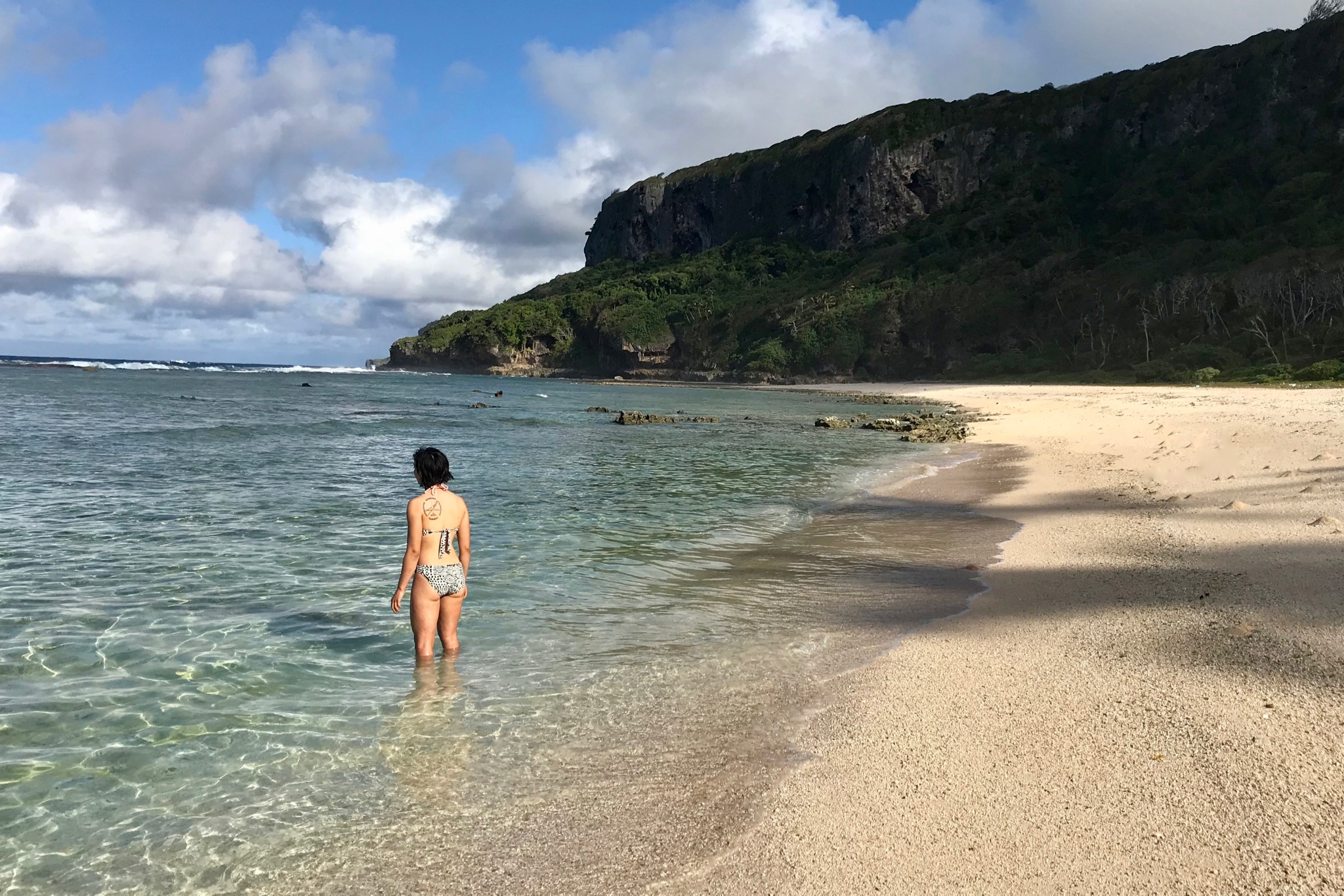
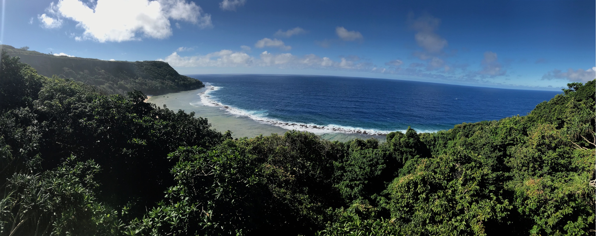
I opened up the “maps.me” app on my iphone and checked where we were on the Eua map I had downloaded previously. It seemed we were on a track that would potentially give us access if we were prepared to abseil from the top of the cliffs, but that was not our plan. So we had to head back up the hill and take a right to head further north towards Fangatave Beach. 20 minutes later we were in some open fields at the top of the cliffs above Fangatave beach, having widely skirted three large snorting bulls in a higher field a few minutes earlier. It was just before 11am and we caught our first sight of the whale wall, further south down the coast.
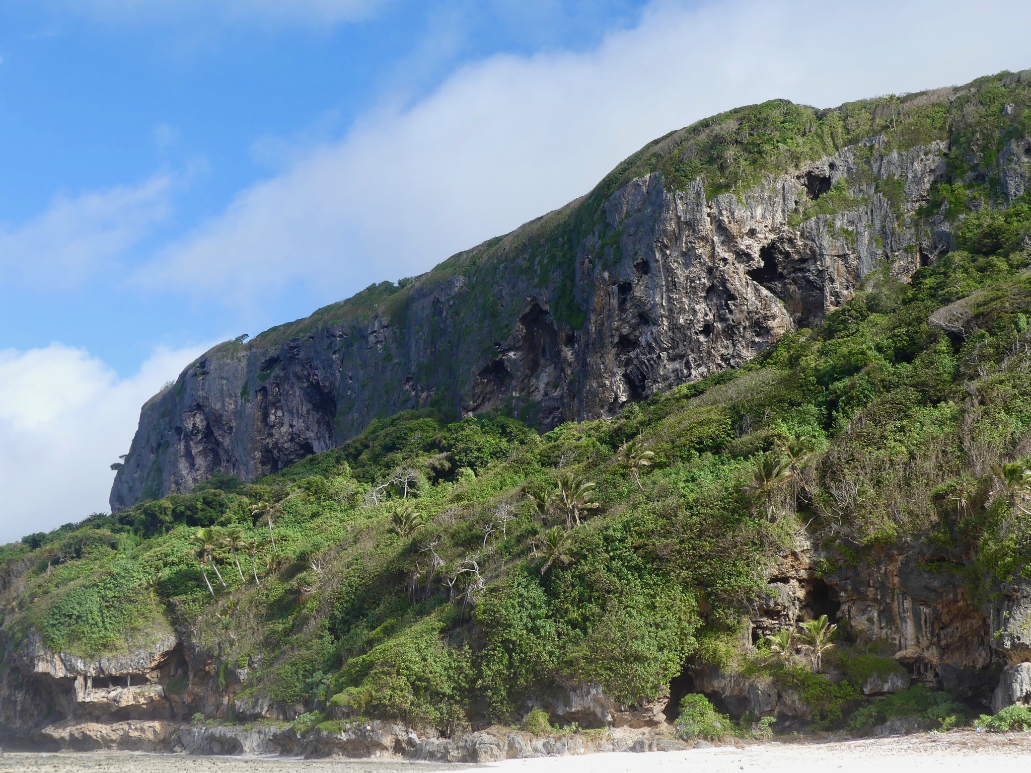
It took another few minutes to realise with the help of GPS and the trail map on my phone that we needed to travel still further north and back into a forested area to find the Descent Gully, marked at the top by the “whale tail tree” and some fixed ropes that enable an initial down-climb over rocks to a steep trail below. We started down descent gully at 11:20am.
Near the beach, this trail descends through a cave system before finally depositing us near the north end of the beautiful Fangatave Beach. By now we had been walking for 1 hour and 45 minutes and we were hot and tired, but the location was magnificent.
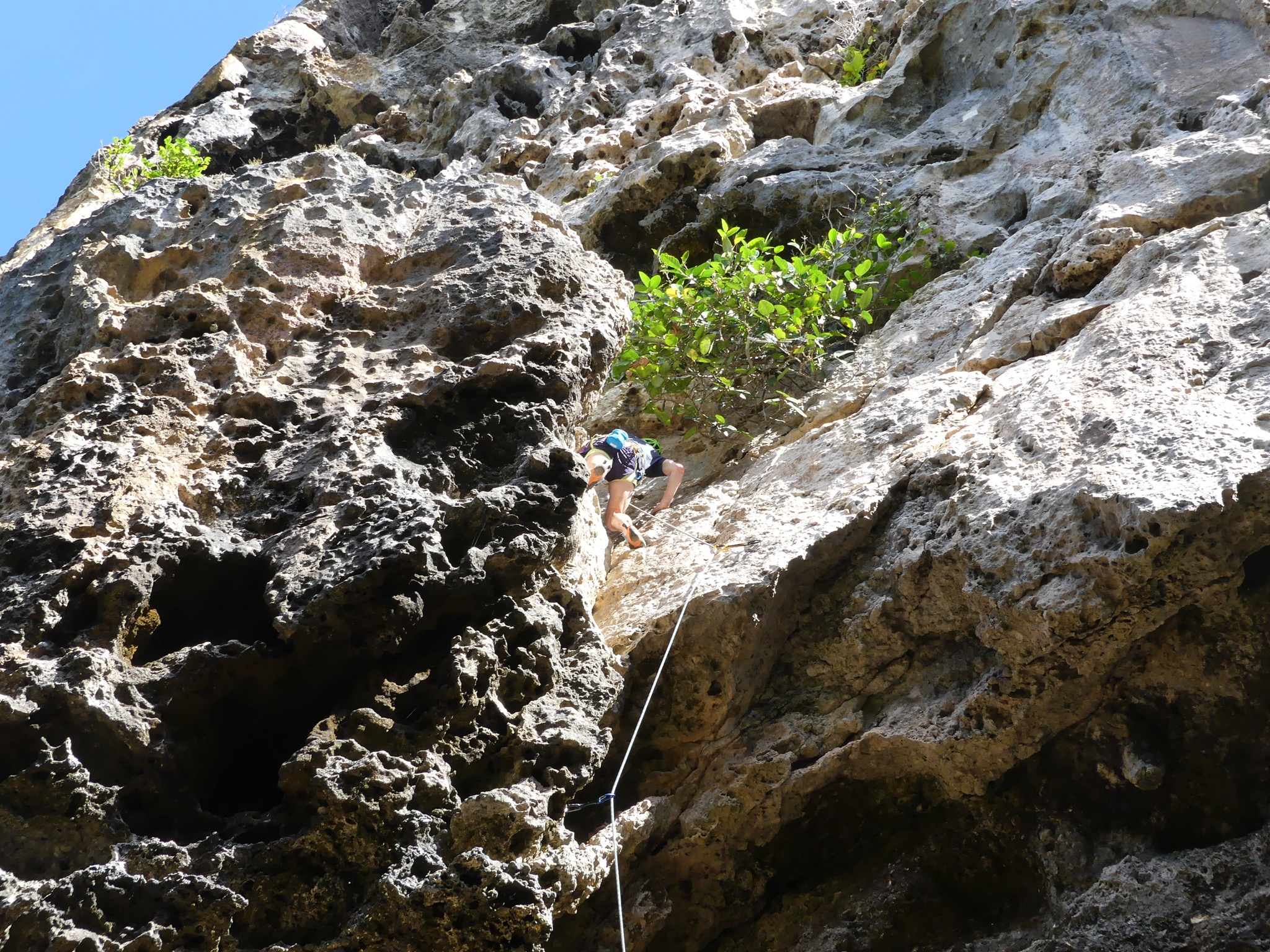
From the beach the approach directions in the official crag guide were sufficient to guide us to the southern end of the beach, and up the rocks into another cave system, which we navigated (with the help of a tree on a high ledge) to the forest above. After a few more minutes of following the trail we finally arrived at the Whale wall, just over 2 hours after we departed our car. But we were not disappointed. It had been an exotic adventure and the rock was very nice to climb. Nevertheless we were so tired that we only tried a few routes on this first day, deciding that we would save energy for our second visit, when we would be more prepared for the approach!
I have made separate posts for the second and third days of our trip :)