Griesalp - Hohtürli Pass - Blümlisalphütte - Oeschinensee - Kandersteg, Switzerland
This two-day hike changed my life. It was the second significant alpine hike that I did in the Swiss alps and the beginning of a habit that I hope to continue for a long time. Not only is Tanja the doyen of phylodynamic likelihoods but she is also an awesome expedition leader and my personal swiss alps guru. This hike was another classic, with a great team of talented scientist-hikers to share the experience with: Tanja, Nikki, Helen, Denise.
Griesalp to Blümlisalphütte
The hike was an alluringly simple offering. We started at Griesalp Kundhaus (1408m) and we would hike a variation of the route over the Hohtürli Pass (2778m) an alpine pass over the col between the peaks of Wildi Frau (3260m) and Dündenhorn (2862m).
Our variation would take us on a long route up to Hohtürli by first going up the left hand side of the Gornernbach valley towards the Gamchi glacier, before crossing the valley floor and winding our way up and over to the saddle which Blümlisalphütte (2840m) overlooks. This is one of the highest huts I have stayed in and our chosen route added some extra elevation gain for a total of 1900m/500m elevation gain/loss over a 12km hike, making it a very good day’s work. More on that and life-changing experiences later.
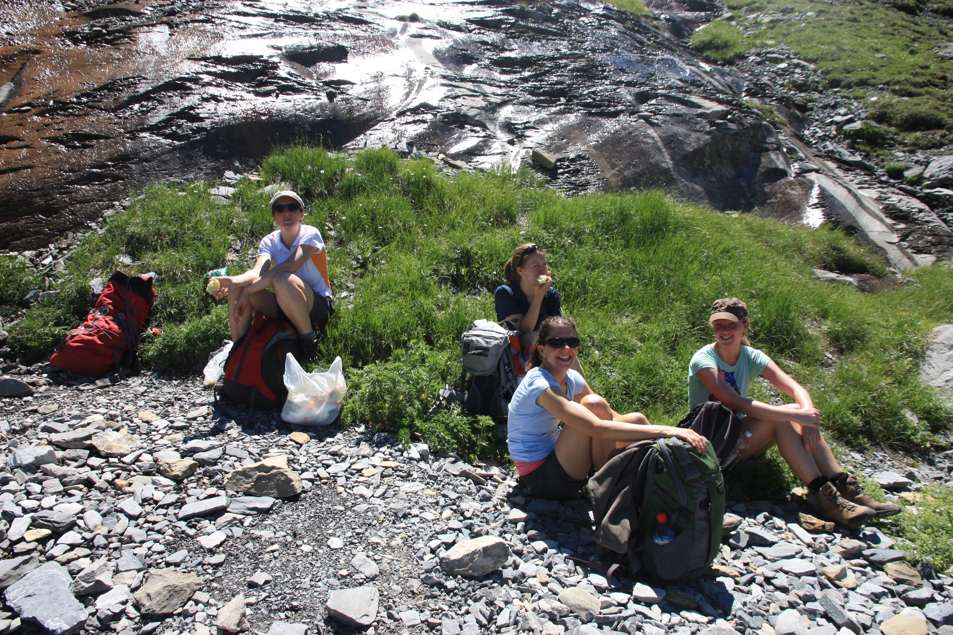
We left Griesalp Kundhaus just after 10:30am in the morning and made good progress. By 12:30pm we had found a spot for a short early lunch about 5.8km up the trail at an altitude of about 2000m. The view up the valley included the peak of Wildi Frau (3260m), which looms large over the Blümlisalphütte SAC and is a popular summit tour from the hut.
Crossing valley floor of Gamchi and Gornernbach
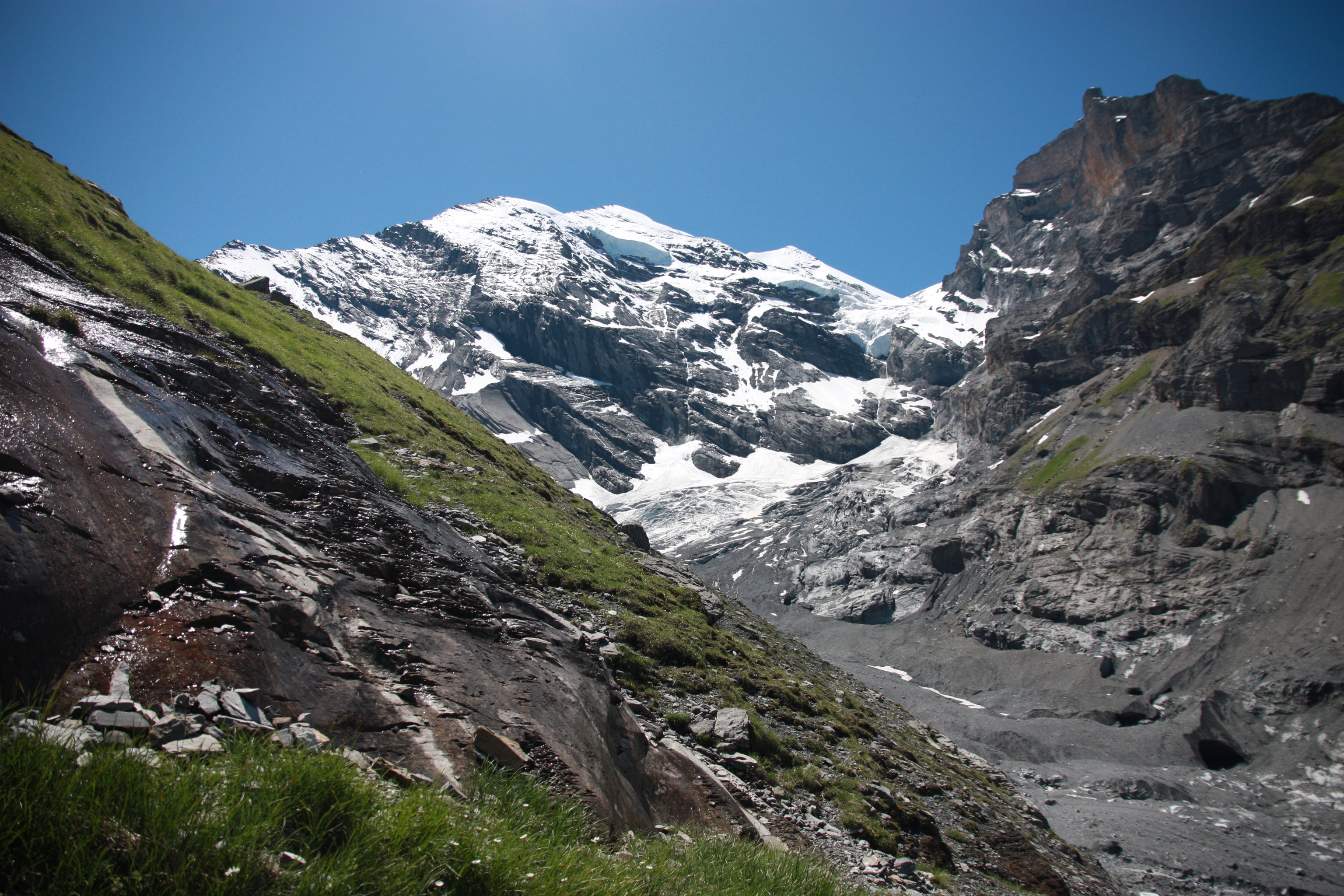
The Gornernbach is fed by the shrinking Gamchi glacier (Gamchigletscher) and the upper valley is scree, moraine and melting ice. Crossing the valley requires the use of two permanent bridges over deep crevasses that extend for about a kilometre down the valley below the glacier.
We picked our way through the moraine, with the Gamchi glacier melting above us causing little waterfalls to tumble down the rocky sides.

We passed below some very large ice arches caused by the melting of the Gamchi glacier. These were so symmetrical, massive and smoothly shaped that I almost mistook them for some sort of swiss engineering feat. Unfortunately from photos I have since seen of the same area, by 2017 many of these arches have melted completely away as the glacier continues to recede.
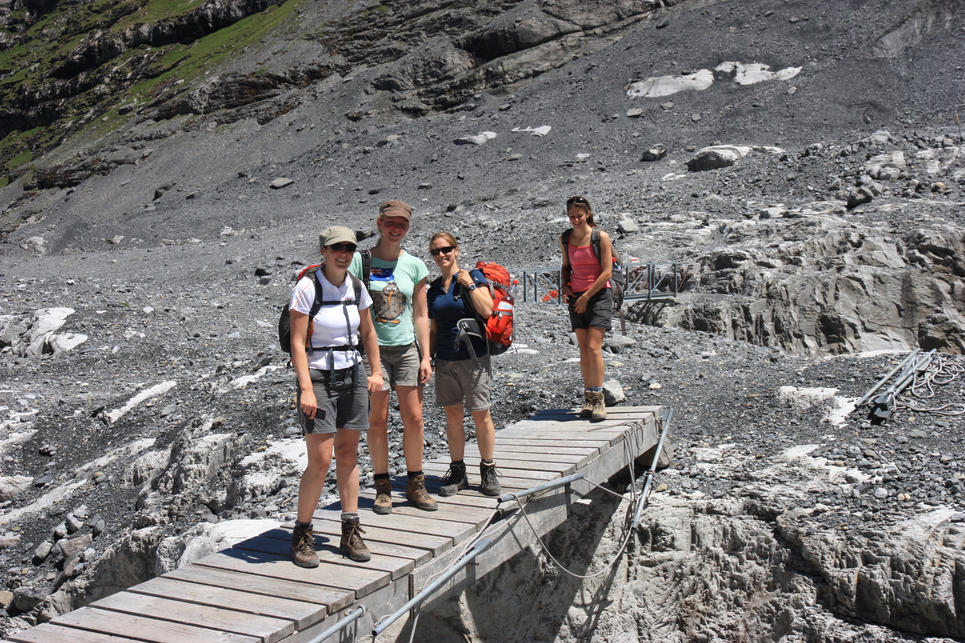
After crossing the bridges and picking our way through the tumbled rocks for about half an hour we climbed up and over the other side of the valley onto a high alpine meadow above Bundalp.
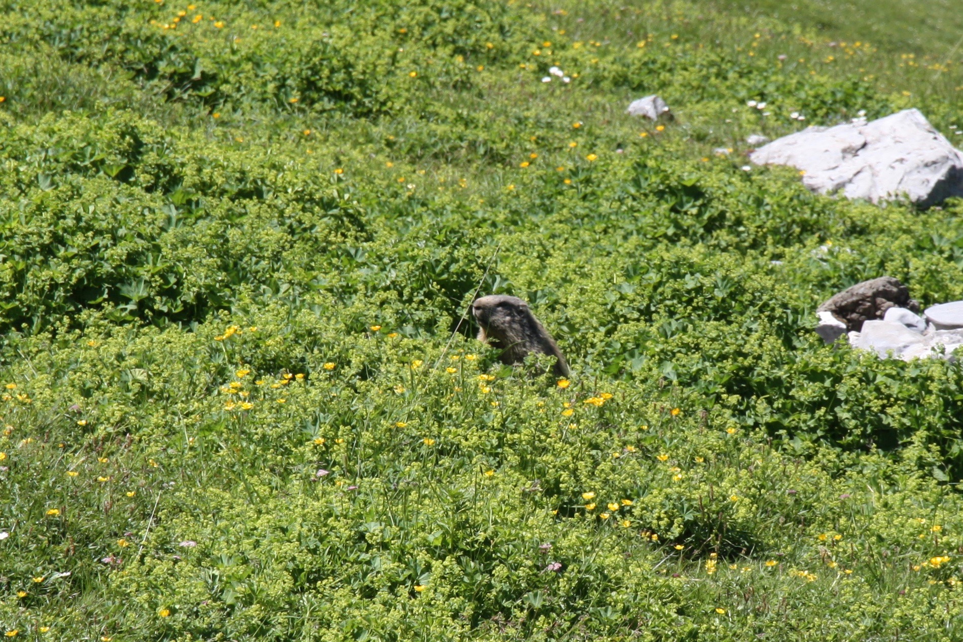
Delightfully just before arriving at Bundstägbach we came across some marmots among the alpine meadow flowers.
The final ascent to the Hohtürli and Blümlisalphütte
A few minutes after seeing the marmots the steepest and longest section of continuous ascent was upon us.
We were less than 4km from the hut, but we had to climb another 800m vertical, after already having been walking for 3 hours. We started the last part of the climb just after 2pm and we didn’t make it far before deciding to have a proper break for a second lunch just after 2:30pm.
I wanted to stop
An hour later, we had only resumed walking for 15 minutes or so when our progress startled a group of five chamois, who duly thundered down the scree slope away from us until they had made it down to the alpine meadow we had left a while before, where they apparently had sufficient distance between us and them to feel comfortable again.
It was 3:30pm, 4h 55m had elapsed since we began the hike and my Garmin handheld GPS device said that the altitude was 2410m. By my reckoning that was 1000m higher than we had started, and I was feeling tired. Despite the fact we had only travelled a little more than 10km, I stopped, took my pack off, sat down next to the track and told Tanja that I had walked far enough. “1000m higher!” I declared. “That is enough for me. Bring the hut down here to me.” I was making light of the situation but actually I was beat. So the rest of the team sat down and somebody dug out a chocolate bar for me. I ate it and drank some water and sat. I could tell the others wanted to continue, but it took me a full 15 minutes before I got going again.
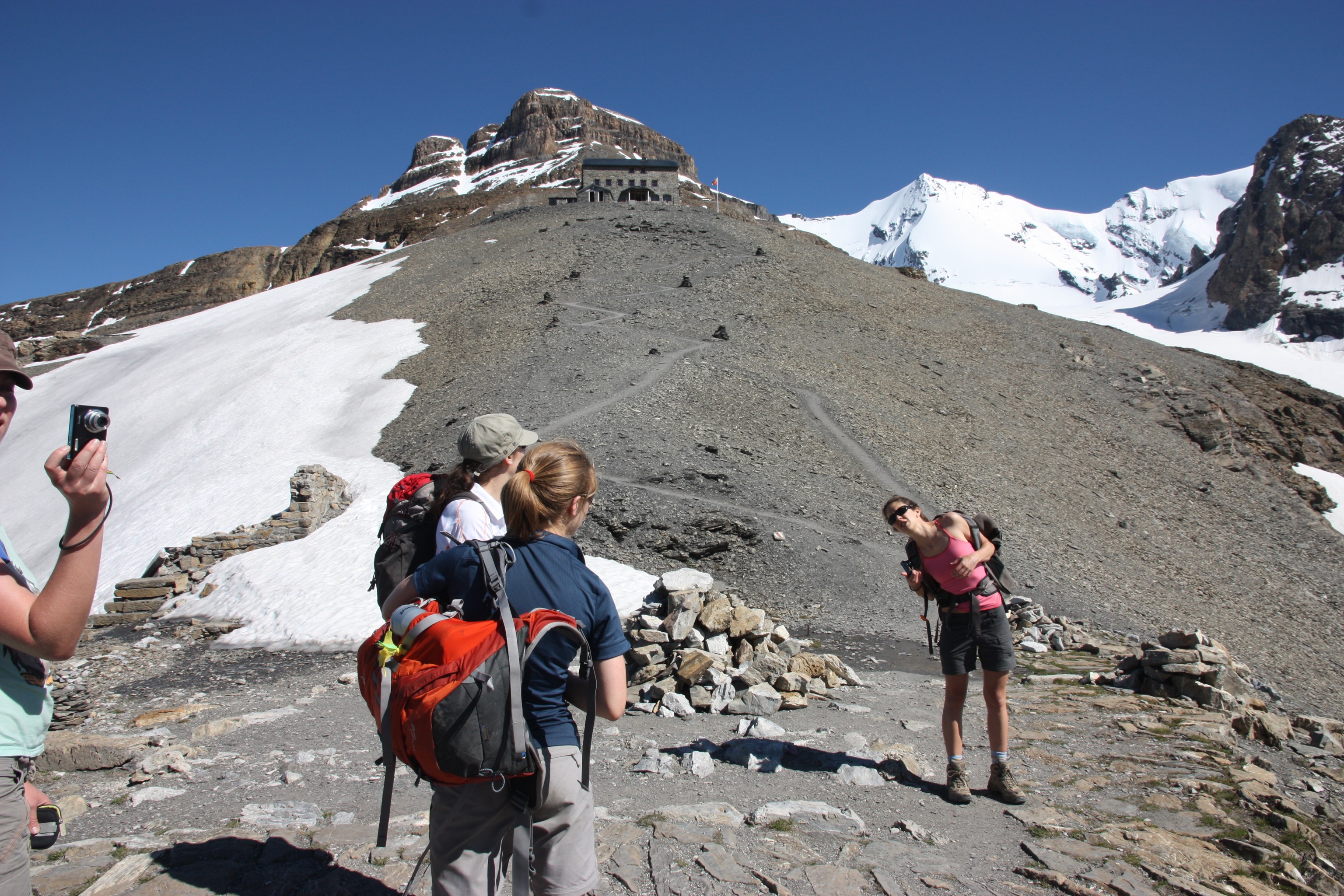
We started again. There was still 400m vertical of hiking left. We walked for another 10 minutes and about 100m vertical and I felt I needed to stop again. What was happening?! I felt wretched. Not just because I was tired, but because I was letting the team down. It took me 8 more minutes to start walking again and somehow I continued until I got to Hohtürli (2778m) at about 4:45pm.
My life had changed.
I didn’t realize it right then. But the difficulty I had felt getting up the final section of this day of hiking set in motion some life-changing decisions.
Hohtürli
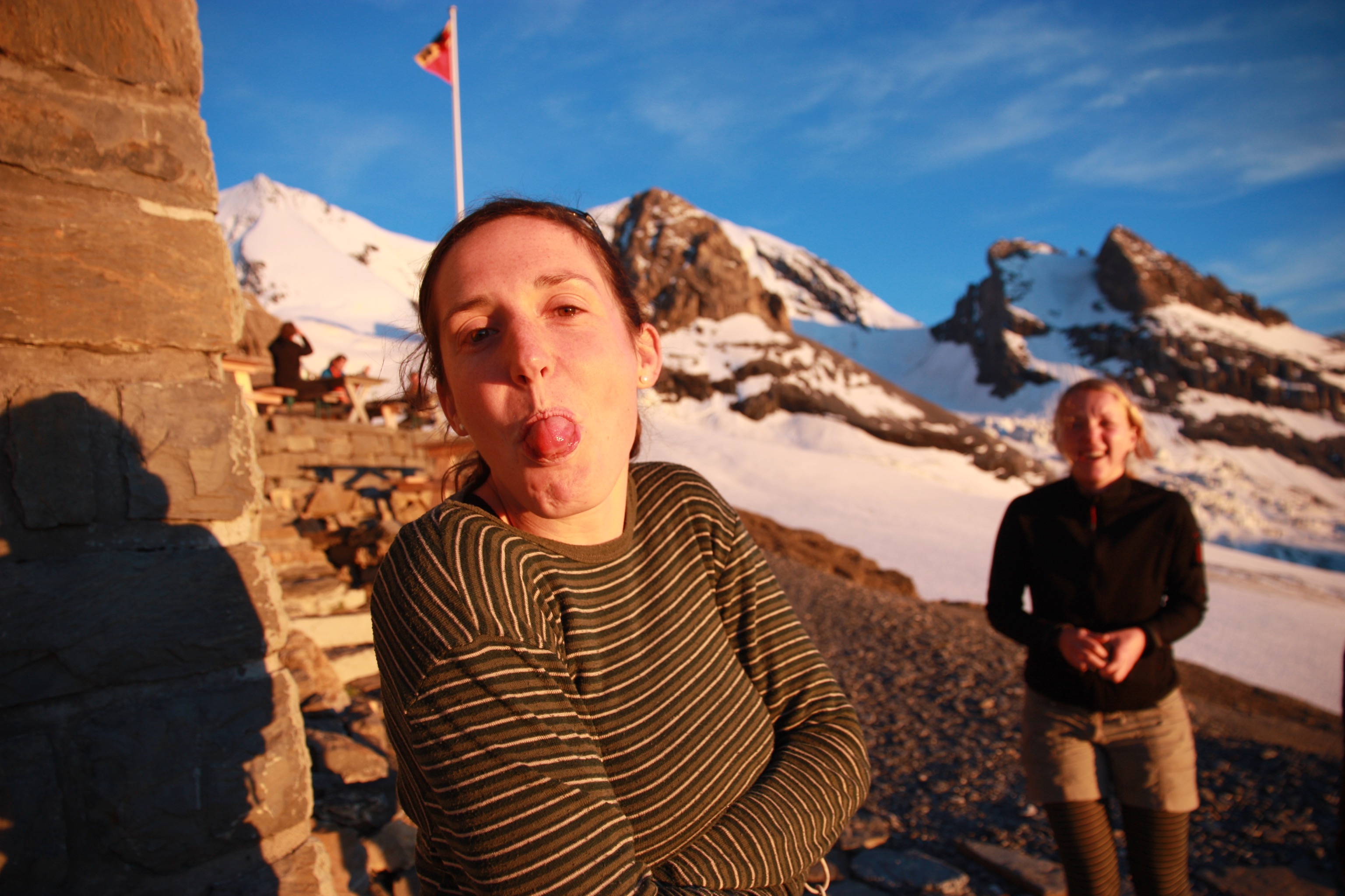
Blümlisalphütte
Finally arriving at Blümlisalphütte at 5:30pm was a very sweet feeling indeed.

Blümlisalphütte to Oeschinensee to Kandersteg
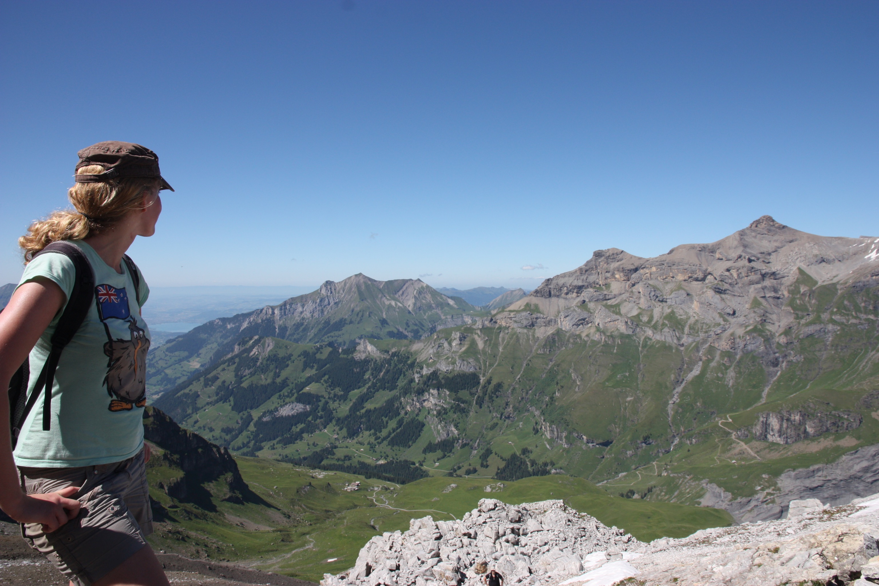
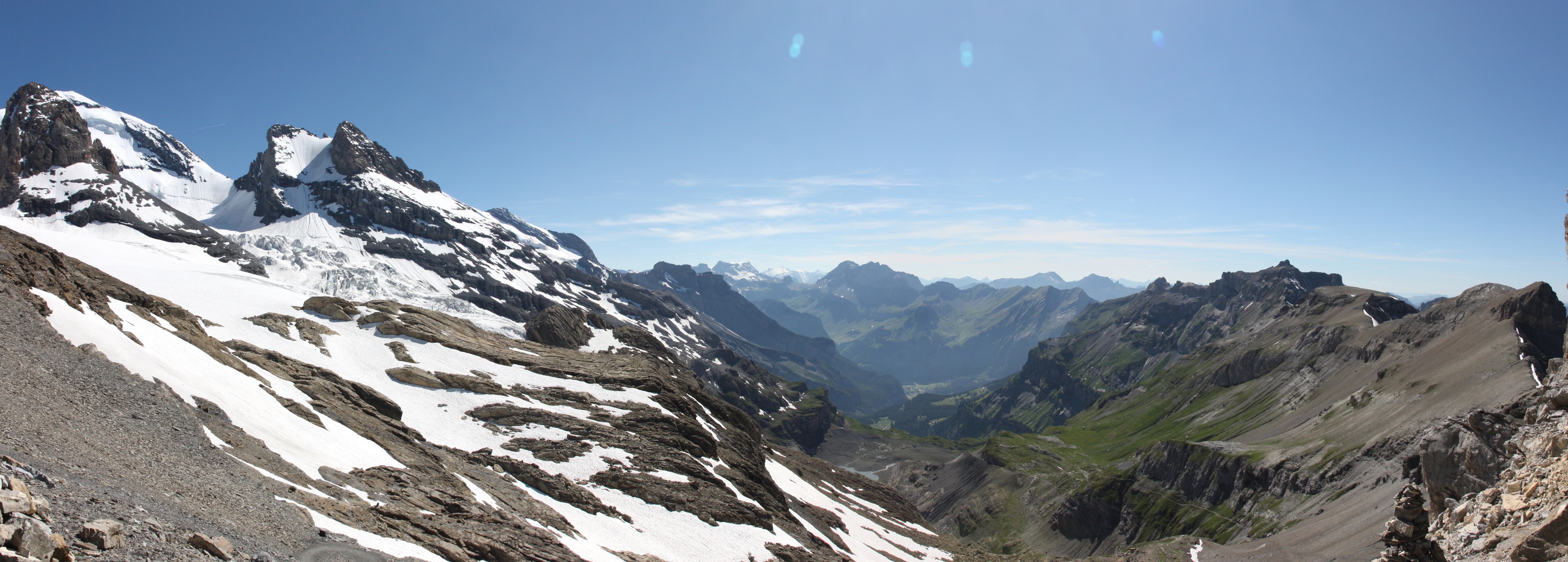
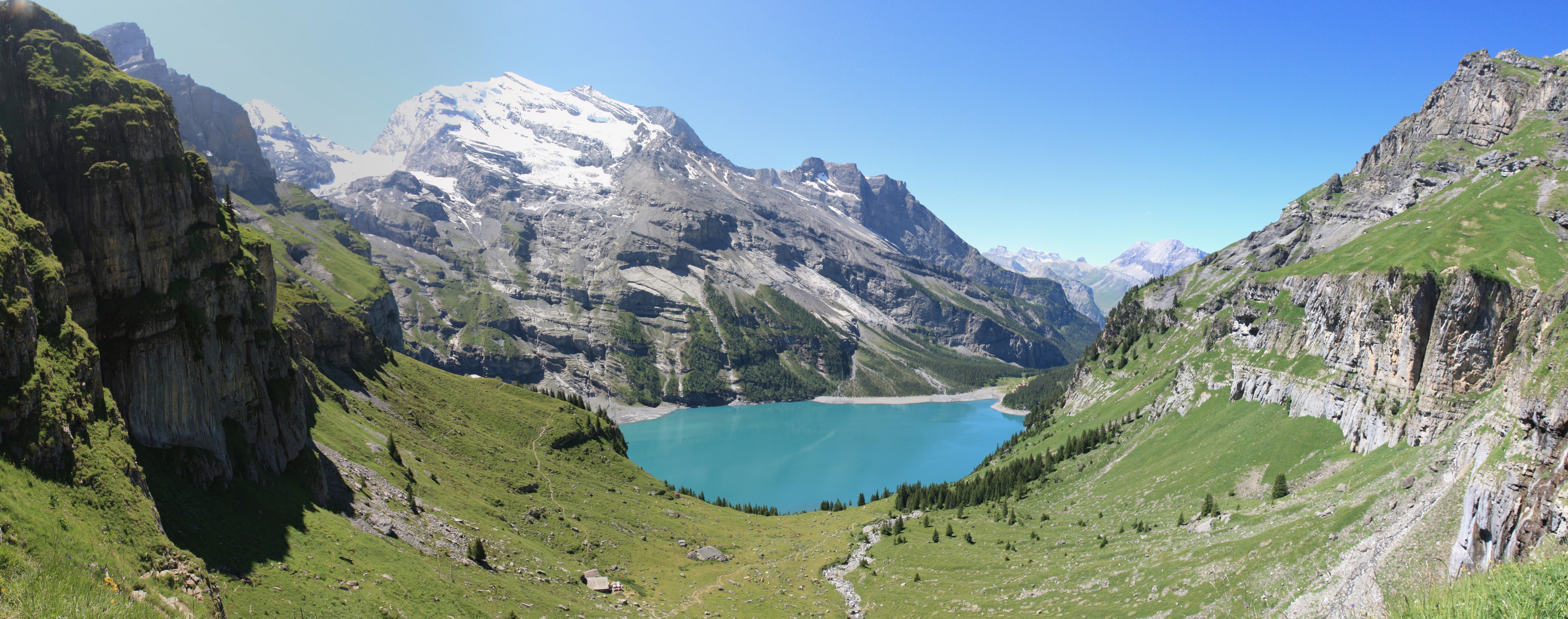
The second morning I was refreshed and revitalized. The major ascent was behind us and the new day would take us down the west side of Hohtürli, to the beautiful alpine lake of Oeschinensee and then on to Kandersteg. The view from the hut was stunning on a glorious morning.
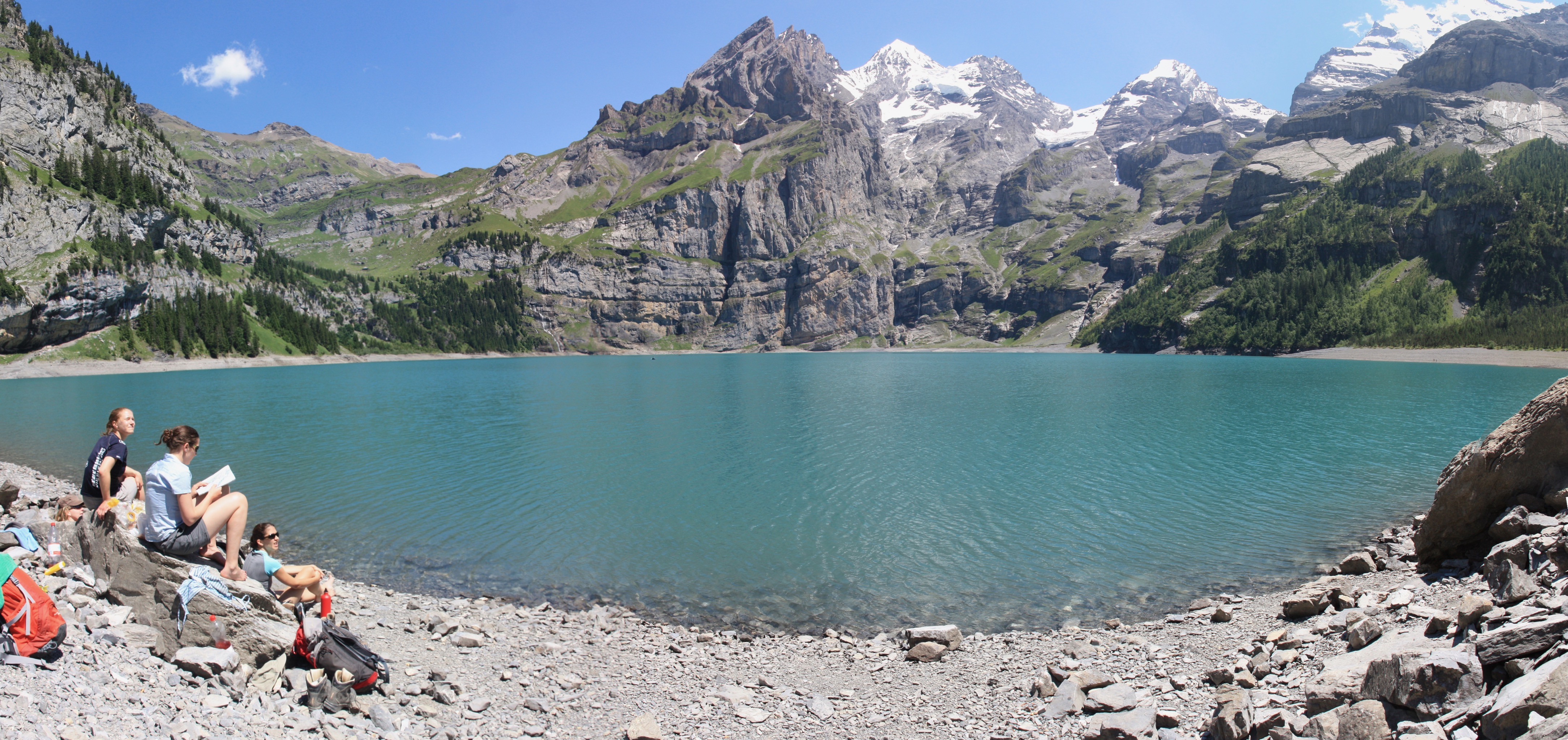
This day raced passed and I raced ahead down the track, in my element. I was probably not a huge amount of fun as I disappeared off ahead for periods of time. But the view of Oeschinensee from the north with Doldenhorn (3638m) rising behind it definitely halted my progress.
Our final stop before Kandersteg was for a long stop beside the lake including a swim :)
What a fantastic weekend it had been! As soon as I got back to New Zealand I resolved to start regularly running to improve my health and fitness. Fast forward 7 years and I run 2-3 times every week and feel fitter now then I did that day in 2011 when I struggled up to the Hohtürli.
Thank you Tanja, Nikki, Helen and Denise! Thank you very much.